Expert Ground Control Point Services

What are Ground Control Points ?
Control points are precise, surveyed locations on the ground used in mapping, photogrammetry, and GIS projects to align aerial or satellite imagery with real-world coordinates. They act as reference markers that ensure accuracy in drone surveys, 3D mapping, and land development projects. By using control points, surveyors and engineers can correct distortions, improve georeferencing, and produce highly reliable spatial data for construction, agriculture, and environmental analysis.
Our Products
 01.
01.Aerial Tags
Aerial tags are high-visibility markers used in drone surveying and photogrammetry to improve accuracy and alignment. They provide clear reference points for mapping, 3D modeling, and geospatial data collection.
 02.
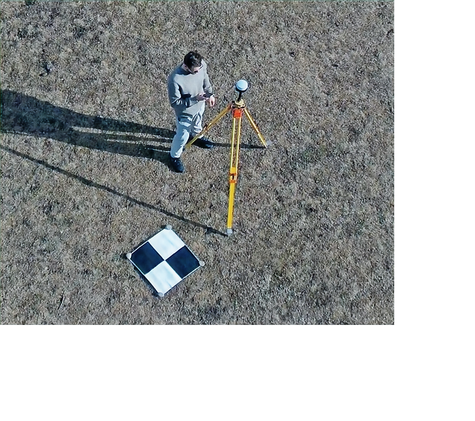
02.24"x24" UAV Drone Checkerboard GCP
durable, high-contrast markers designed for precise aerial mapping and photogrammetry. Ideal for enhancing survey accuracy and georeferencing in drone-based projects.
 03.
03.48” XL LiDAR Ground Control Point
offers a large, high-visibility surface for superior accuracy in LiDAR-based aerial mapping and surveying. Built for durability and precision in demanding field conditions.
 04.
04.16-bit April Tags (4x4 Array) UAV Drone GCPs
high-precision ground control points designed for drone surveying and mapping. Their 4x4 array ensures accurate georeferencing and reliable data for 3D mapping and photogrammetry projects.
About ControlPoint Experts
Leading the Way in Ground Control Points
ControlPoint Experts is dedicated to providing top-notch ground control point services. Our team is committed to delivering high-quality products and informative content aimed at attracting specific clients with good products.

ControlPoint Experts provides high-accuracy Ground Control Points (GCPs) for drone surveying, photogrammetry, and aerial mapping projects. Their durable, easy-to-deploy targets ensure precise georeferencing for industries like construction, agriculture, and land surveying.


Client Testimonials

“ControlPoint Experts provided us with exceptional service. Their attention to detail and dedication to their clients is truly commendable.”
Jade G.